")
")
")
![]()
Location U-Boat 2
Brief information about the find
During the exploration of the bottom of the southern inner fjord, the observations shown in the figures were made at the position 54°50.0752'N and 009°28.3491'E.
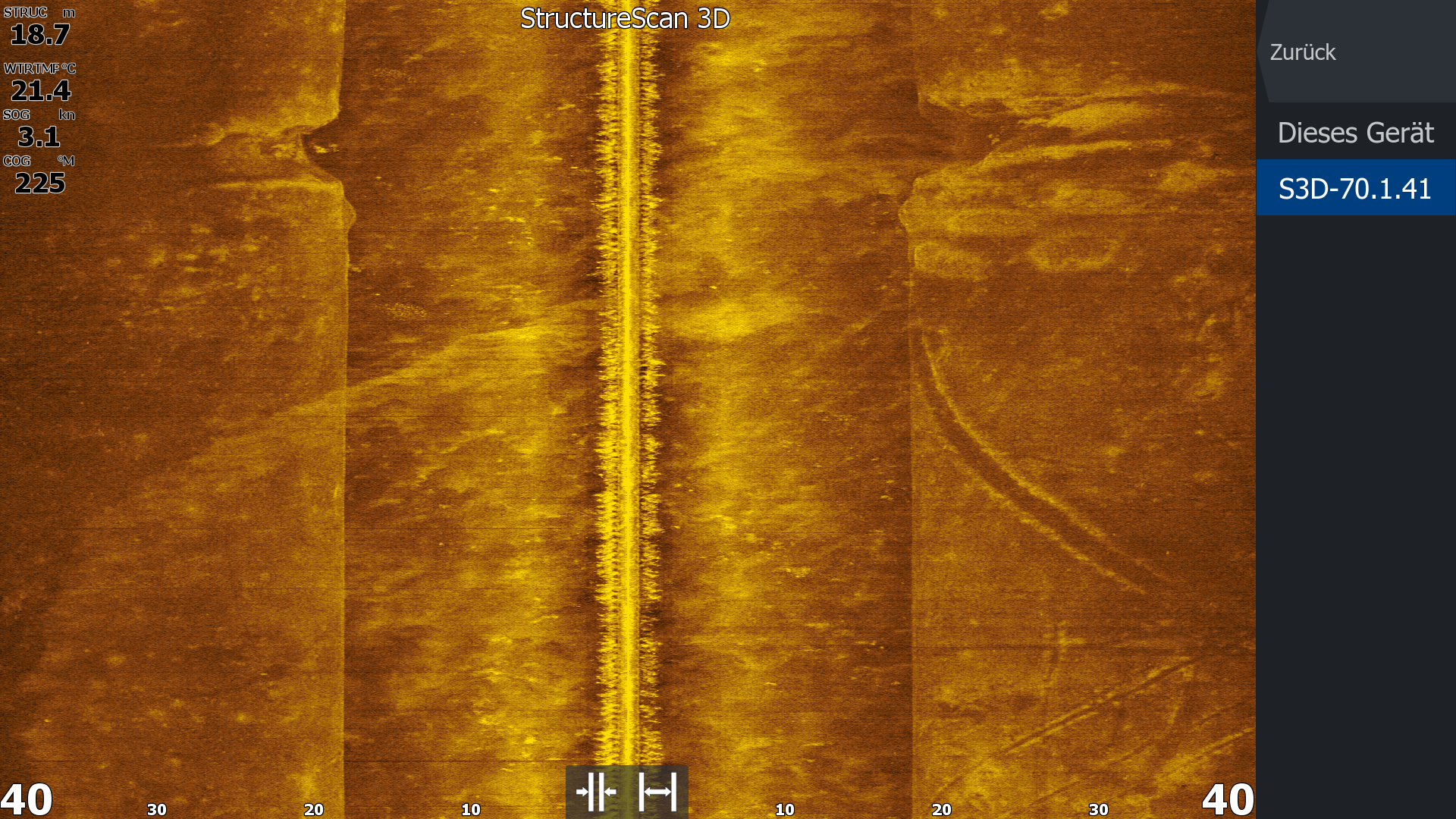 The side-scan image shows an approximately 60 m long depression on the bottom in the upper part of the image. This depression is up to 10 m wide.
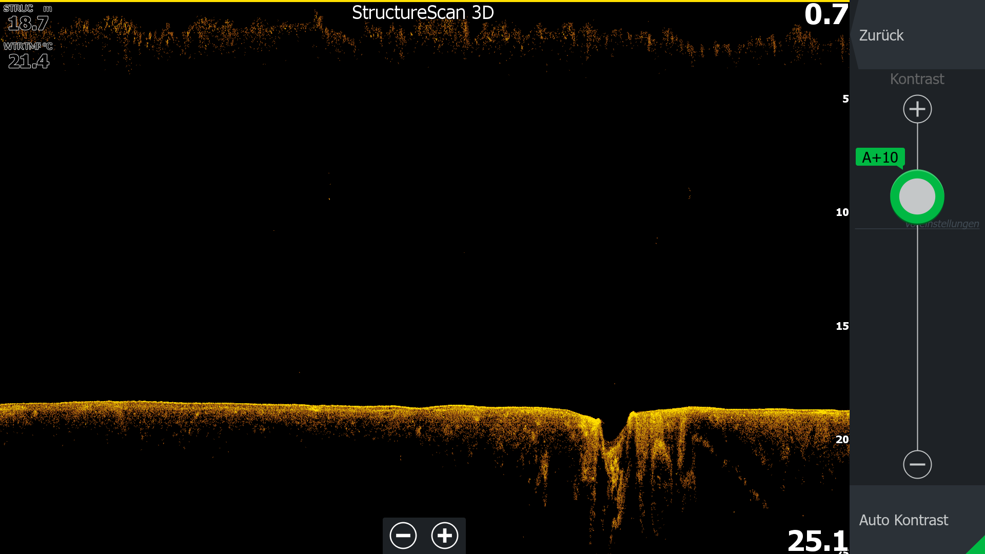 The down-scan image underlines this finding.
The echogram is interesting. It is the most informative for measuring the find. It shows the depression mark, which extends approximately 1.2 meters into the surrounding ground at the measured location.
The loose sediment (mud and biogenic precipitation) is pressed deep into the ground here.
These observations provide evidence of the sinking site of a German submarine, presumably a Type 7 (C?). This submarine type was the most common in the Kriegsmarine during World War II. The remains of a submarine of this type were located south of the Ochseninseln last year. These boats were scuttled on May 5, 1945, to escape Allied control (Operation Regenbogen). However, the sunken submarines, which possessed considerable material value, were raised in the postwar years. When it was not possible to salvage them in their entirety, the wrecks were blown up and recovered in pieces.
However, the extent to which the current find actually represents the sinking site of a submarine remains uncertain. A possible find must therefore still be confirmed through diving. The site lies between 16 and 18 meters deep. The bottom is assumed to be very muddy.
Further reports on the current status will follow.
21.07.2025 C.M.Hansen